
World Data Atlas from Knoema is a new, free application that provides quick access to country statistics. Perfect for a history or social studies class, the World Data Atlas is an easy to use tool that lets students explore an enormous variety of information about all the countries of the world. Let's take a look!
For you regular readers, there's one thing we have to do before we really dig into the review, and I think you know what it is: Introductory video!
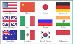
As you can see, it's a pretty comprehensive resource. Plus, it's available as a Chrome application (if you're a Google Chrome user) or as a stand alone website. When you first arrive at the World Data Atlas, you'll be presented with the main screen where you can search by country or indicator.

Welcome to the World Data Atlas!
After selecting a country, you'll see a screen with some basic statistics on size, population, leader, and so on. From here, you can compare the country to any other country (which is a wonderfully useful feature) or dig deeper with more specific indicators. And, as the video mentioned, each country has over 1,000 specific indicators you can look through.
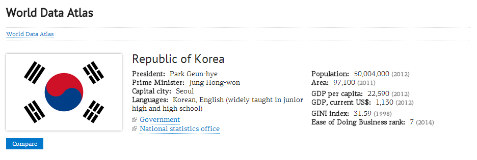
Basic Country Information
If you click on a specific indicator you'll be presented with new options like exporting the data (as a CSV, Excel, PowerPoint, or PDF file), exploring the data in graph form, comparing the data, seeing the global rankings of that particular indicator, or viewing a map which let's you compare every country in the world.
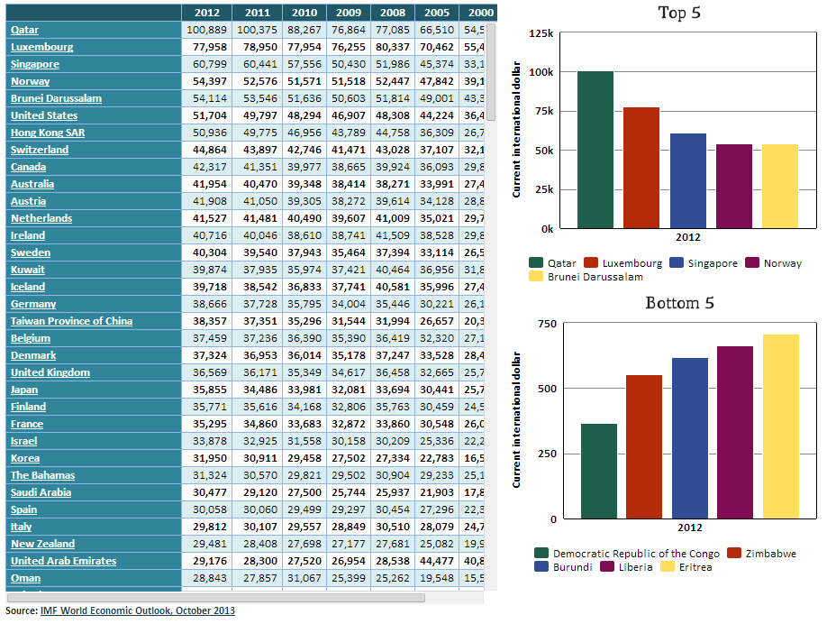
Comparing the Worldwide Rankings of a Particular Indicator
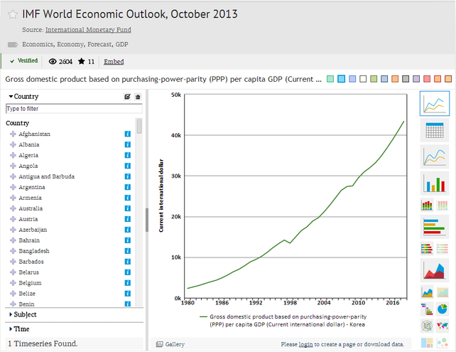
Graphing the Data. You Can Also Add Additional Countries to Compare.
The map feature is particularly handy because you can view how countries have changed over time, all the way back to 1980. It even includes predictions for future developments.
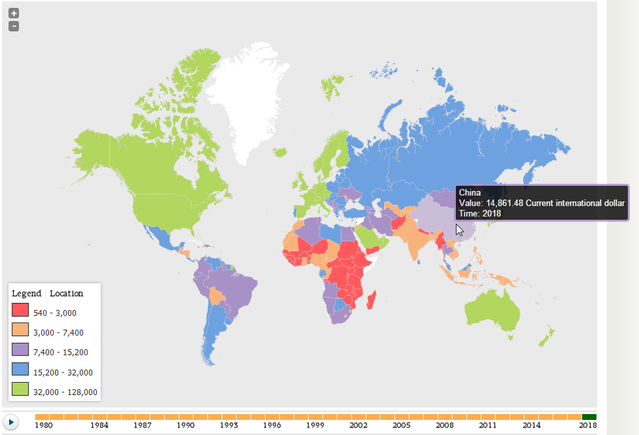
Comparing Countries with the Map Function
And basically, that's it! The amount of information and knowledge available through this service is incredibly deep, but the interface is simple enough that even elementary students would be able to use it without much difficulty. Plus, the options for comparing and exporting data are excellent resources that would be helpful in even the most advanced social studies or history class.
In short, the World Data Atlas is an excellent application and perfect for anyone looking for statistical information on countries.

The opinions expressed in this review are my own. I was not compensated for reviewing this application


 RSS Feed